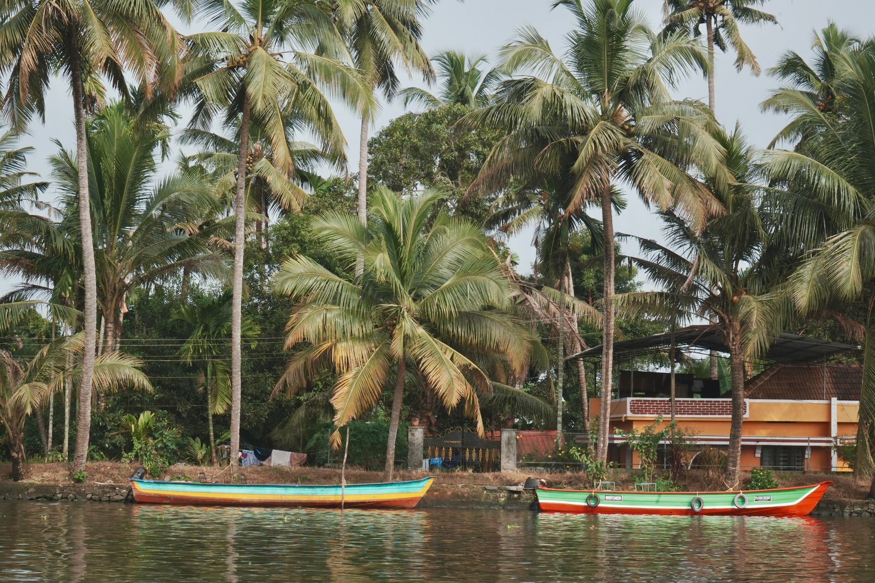

Why the weeks after the rain are the best time on the water's edge
Kochi's southwest monsoon runs roughly June to August, and the retreating showers of September and October leave the backwater fringe at its most walkable: silt settles, the light softens, and the coconut palms along the canal banks put out new fronds. Daytime temperatures sit around 28-31°C rather than the April peak, and the ground dries within a day or two of a heavy shower. If you are booking, target late September through November for green edges without the downpour, or January and February for the driest, coolest walking.
The catch is drainage. Much of the backwater edge sits at or barely above water level, so a high tide combined with heavy rain can leave standing water on unpaved lanes for a few hours. Locals plan errands around the tide table rather than the clock. Practical kit: quick-dry shoes with grip, a light rain shell rather than an umbrella on narrow paths, and mosquito repellent for the hour after sunset, when the canal banks turn humid.
Walking the edges: Kumbalangi, Panangad and the Vembanad shore
Kumbalangi, on the islands south of the Ernakulam mainland, is the classic backwater-edge walk — narrow concrete paths between Chinese fishing nets, prawn ponds and small boat jetties. From Ernakulam South railway station, the drive is roughly 12-20 km depending on route and takes 35-50 minutes in traffic. Walk early, from about 6.30am, when the nets are being worked and the paths are dry. Midday is punishing: almost no shade on the pond bunds. Carry water; there are few shops once you leave the main village road.
Panangad and the Vembanad shoreline toward Kumbalangi offer quieter, flatter lanes with paddy on one side and brackish water on the other. This is where you notice the post-rain change most — dragonflies over the channels, herons on the paddy bunds, and the smell of wet earth rather than diesel. Paths here are a mix of tarmac and packed earth. After heavy rain the earth sections hold water, so stick to the tarmac loops and the bund roads. A three to five kilometre loop is realistic in an hour and a half at an easy pace.
Fort Kochi, Mattancherry and the city-side edges
Fort Kochi is not backwater proper, but the edges count: the promenade along the harbour near the Chinese fishing nets, the lanes behind Vasco da Gama Square, and the walk south toward the beach at Kannamali. After rain the heritage lanes drain reasonably well because they are paved and slightly cambered, but the harbour-front path can be slippery with algae. The walk from St Francis Church down to the beach takes about 20 minutes at a stroll. Early morning and the hour before sunset give the best light and the most activity.
Mattancherry, a short auto-rickshaw ride or a 25-minute walk north-east from Fort Kochi, is where the backwater meets the old trading quarters — narrow lanes around Jew Town and the Dutch Palace, with the boat jetty at the eastern end. The ground here is uneven and the lanes flood briefly in heavy rain, so visit after the morning shower rather than during it. The mattancherry jetty area is a working waterfront, not a promenade — watch your footing and give way to loading.
Where to stay, and what to skip
For backwater-edge walking, base yourself in Fort Kochi if you want restaurants and heritage lanes on foot, or on the islands south of Ernakulam if you want the water at your doorstep and do not mind hiring an auto-rickshaw or driver for the day. Fort Kochi suits first-time visitors; the island edges suit repeat visitors and anyone who wants mornings without traffic. The drive from Fort Kochi to Kumbalangi is about 30-40 minutes outside peak hours, so a day trip is easy rather than a slog.
What I would skip: mid-afternoon walks on the open pond bunds in Kumbalangi, and the harbour-front path at Fort Kochi immediately after a downpour, when the algae makes it genuinely slick. Skip the temptation to walk rural canal paths after dark — there is no lighting and the edges are unfenced. Also skip the busiest houseboat boarding jetties if you only want a walk; the noise and diesel fumes undo the point. Book a hotel in Fort Kochi or Ernakulam and treat the islands as a morning excursion.
For a longer walk with a backwater feel without leaving the city, the Marine Drive promenade in Ernakulam runs about three kilometres along the harbour and drains well after rain. It is paved, lit, and busy in the evening, which makes it the practical choice on a wet day. Combine it with a morning at the Mattancherry jetty and you cover both the city edge and the old trading waterfront in one day.
Where to stay
Hotels in Fort Kochi


Good to know
Questions, answered
What is the best month to walk Kochi's backwater edges?
Late September to November, when the monsoon retreats and the edges are green and dry within a day of rain. January and February are cooler and driest, but the greens fade. Avoid April and May, which are hot and humid before the monsoon.
How do I get from Fort Kochi to Kumbalangi?
By road: roughly 20-25 km and 30-40 minutes outside peak hours, by taxi or hired auto. There is no direct train. Buses run but require changes. For a walk, an early start by 6.30am beats the traffic and the heat.
Do the backwater paths flood?
Some do. Unpaved lanes on Kumbalangi and Panangad hold water after heavy rain, especially at high tide, for a few hours. Paved and cambered lanes in Fort Kochi and Mattancherry drain faster. Plan walks for the morning after a dry night.
Is Fort Kochi or the islands better as a base?
Fort Kochi for restaurants, heritage lanes and harbour walks on foot. The islands south of Ernakulam for water at the doorstep, but you will need a driver or auto-rickshaw. First-time visitors usually do better in Fort Kochi.
What should I wear for backwater walking?
Quick-dry shoes with grip, light long trousers or a skirt for mosquito cover, and a rain shell rather than an umbrella on narrow paths. Carry water and repellent. Avoid flip-flops on wet bunds and algae-covered harbour paths.
Can I walk the backwater edges at night?
No. Rural canal paths and pond bunds have no lighting and unfenced edges. Marine Drive in Ernakulam is paved and lit, and is the sensible evening option. Otherwise, take a short auto-rickshaw ride back to your hotel.
What wildlife will I see on the edges after the rain?
Herons and egrets on paddy bunds, kingfishers along channels, dragonflies in numbers, and frogs and crabs on wet paths. This is not a wildlife trip — expect common birds and small creatures, not a reserve. Bring binoculars if you have them.
How long does a Kumbalangi walk take?
A realistic loop is three to five kilometres, about one and a half hours at an easy pace, plus stops. Start by 6.30am, finish by 9am, then take a vehicle to Panangad or back to Ernakulam before the midday heat.
Doing good is the business
Every booking in Kochi removes one tonne of CO₂
Same hotel, same room, same live price you would pay anywhere else — IMPT funds one verified tonne of carbon removal per stay, never added to your bill.