
Neighbourhood picks
Backwater Trees of Kumbalangi: A Short Guide for Curious Walkers
A walker's field guide to the mangroves, palms and rain trees of Kumbalangi island, with practical routes from Kochi and what to expect on the ground.
Getting to Kumbalangi from the city
Kumbalangi sits about 15 km south of Ernakulam, reached by road through Fort Kochi and Thoppumpady, or by a short ferry hop across from Willingdon Island and Aroor. By taxi or auto from Fort Kochi expect 25–35 minutes depending on the Thoppumpady junction; from Ernakulam South railway station allow 40–50 minutes. Buses on the Aroor route drop you at the Kumbalangi junction, from which the panchayat roads into the island are flat and largely shaded. Mornings before 9 am are noticeably cooler and quieter.
The island is a cluster of wards rather than a single village, so decide where to start. The main tree-lined stretches run between the Kumbalangi junction and the Chinese fishing net viewpoint on the western edge, and along the canal roads towards Chellanam in the south. The best months are November to February; by late March the humidity makes midday walking heavy. Carry water, wear covered shoes for the muddy shoulders, and remember that several paths pass private homes and working yards.
Mangroves: the trees that hold the island together
Kumbalangi's western and southern fringes are fringed with mangrove — mainly Avicennia and Rhizophora species, recognisable by their pencil-like aerial roots and arching stilt roots respectively. These are not ornamental; they buffer the island against tidal surges and nursery the prawns and crabs that the local economy depends on. The densest stands are along the backwater edges near the Chinese fishing net viewpoint and the canal mouths towards Chellanam. Walk the bunds at low tide when the root systems are fully visible; at high tide you will see little but water and canopy.
Do not step off the bund into the mudflats. The substrate is soft, cut by crab holes, and easy to sink into above the ankle. Viewing from the raised paths is enough, and local guides who run the community tourism programme will point out species and explain the pokkali paddy-mangrove rotation that shapes this landscape. If you want a boat, small country craft leave from the net viewpoint area; negotiate in person and confirm the duration before boarding.
Coconut palms, rain trees and the village canopy
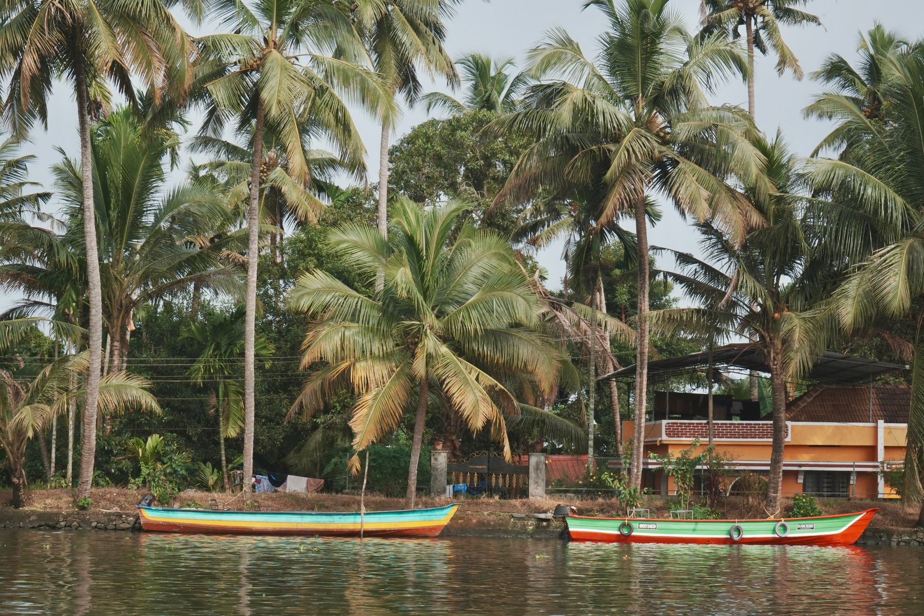
Away from the water, Kumbalangi is a working coconut landscape. Tall palms line every lane, interspersed with breadfruit, mango and jackfruit in the compound gardens. The most impressive single trees for a walker are the old rain trees and banyans near the temples and the junction, whose canopies drop the temperature by several degrees. The stretch past the Kumbalangi panchayat office towards the village centre has a good concentration of these, plus the smaller flowering trees — gulmohar and copper pod — that colour the roads in April and May.
Walking here is about lanes, not trails. There is no formal footpath network and no signage beyond the odd panchayat board, so a simple approach works: follow the canal roads, take the shaded side, and turn back when the lane narrows into a compound. Homestays cluster in the central wards and along the canal towards the net viewpoint, and staying a night lets you walk at dawn and again at dusk, which is when the birdlife and the light are best.
Practicalities, and where to base yourself
Facilities on the island are limited: a handful of small tea shops and homestay kitchens, no ATMs, and patchy mobile data in the back lanes. Eat before you go or arrange a homestay meal in advance. Entry to the village tourism programme, where it applies, is modest and best confirmed through your accommodation. Combine the walk with a Fort Kochi morning — the Dutch Palace, St Francis Church and the Jew Town lanes — since the two are close and the road back passes through Thoppumpady.
For most visitors I would book a hotel in Fort Kochi or Ernakulam rather than on the island. Fort Kochi gives you walkable heritage streets, ferries to Willingdon Island and easy access to Kumbalangi by road; Ernakulam suits rail arrivals and business travellers. Kumbalangi homestays suit slow travellers who want dawn birdsong and home-cooked Kerala food. Book two to three weeks ahead for December and January, when Kochi fills up around the biennale and the Christmas season.
Where to stay
Hotels in Fort Kochi


Good to know
Questions, answered
How do I get to Kumbalangi without a car?
Take a bus or auto to Kumbalangi junction via Thoppumpady and Aroor, then walk or hire a local auto. From Fort Kochi the whole trip is roughly 30–40 minutes by road. Ferries connect Fort Kochi to Willingdon Island, but onward transport to the island is still by road.
What is the best time of year to walk in Kumbalangi?
November to February is coolest and driest, with temperatures comfortable for a half-day walk. March to May is hot and humid, so start by 7 am. June to August brings heavy monsoon rain; the paths hold water and the backwater views are dramatic but walking is limited.
Is there an entry fee for the Kumbalangi village tourism programme?
Where the community tourism programme operates, a modest entry or guide fee applies, but rates change and are best confirmed locally through your homestay or at the village office. Do not rely on published figures online, and carry cash since there are no ATMs on the island.
Can I see the Chinese fishing nets in Kumbalangi?
Yes, there is a net viewpoint on the western edge of the island, quieter than the famous Fort Kochi nets. Reach it by auto from the junction or on foot along the canal roads. Early morning and late afternoon are when the nets are most likely to be operated.
Are there places to eat and stay on Kumbalangi?
A few homestays serve home-cooked Kerala meals, and small tea shops sell snacks, but there is no restaurant strip. Staying overnight is worthwhile for dawn walks. Otherwise eat in Fort Kochi or Ernakulam before or after your visit and treat the island as a half-day excursion.
How long should I allow for the walk?
Two to three hours covers the main canal lanes and the mangrove edge at a relaxed pace. Add an hour if you take a short boat from the net viewpoint. Distances are small but the heat and uneven shoulders slow you down, so plan a morning rather than an afternoon.
Should I book a hotel in Kumbalangi or Fort Kochi?
For a first Kochi trip, Fort Kochi or Ernakulam is more practical, with easier transport, restaurants and onward connections. Kumbalangi homestays suit travellers who want quiet and local food. Book December and January stays two to three weeks ahead.
What should I wear and carry for the walk?
Covered shoes for muddy shoulders, light cotton clothing, a hat and drinking water. Mosquito repellent is useful near the mangroves at dusk. Bring cash, since cards are rarely accepted, and download offline maps because mobile data is patchy in the back lanes.
Doing good is the business
Every booking in Kochi removes one tonne of CO₂
Same hotel, same room, same live price you would pay anywhere else — IMPT funds one verified tonne of carbon removal per stay, never added to your bill.